
Bridger Pass, Utah, courtesy Wikimedia.
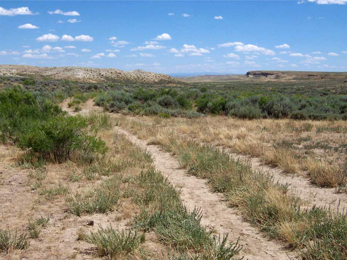
Bridger Pass is a mountain pass on the Continental Divide in southern Wyoming. It has a gradual, hilly terrain in southwestern Carbon County, covered with sagebrush, grasses, and other vegetation. The high surrounding ridges are covered with scrub pine and occasional aspen stands, giving the vicinity a highly scenic quality. It is named after James Bridger, who had traveled through the area before 1861. It was second in importance only to South Pass, Wyoming, as a significant passageway over the Continental Divide during Westward Expansion and migration in the mid-1800s.

James Bridger.
Though it is unknown when people first began to travel over Bridger’s Pass, carbon dating estimates that prehistoric people migrating over the High Plains used it for 11,000 years. Later, Western fur trappers, who customarily followed Indian trails, likely utilized the Pass during the Rocky Mountain fur trade. The noted fur trapper James Bridger discovered the divide in 1842 or 1843.
The first documented crossing of Bridger Pass was by Captain Howard Stansbury of the U.S. Army Corps of Topographical Engineers in 1850. The Stansbury Expedition was returning east after completing a topographical survey of the Great Salt Lake guided by Jim Bridger. Upon reaching Fort Bridger in September 1850, Stansbury hired Jim Bridger as a guide to locate a direct route east, avoiding South Pass. Bridger guided Stansbury’s party along Bitter Creek, Muddy Creek, through Bridger Pass, and past the north side of Elk Mountain before turning north to Fort Laramie.
Stansbury’s report publicized the possibilities of an overland route through Bridger’s Pass and contributed significantly to its later use. The trail over Bridger’s Pass became generally known as the Cherokee Trail, named after a group of Cherokee Indians who had passed through the region in 1849 on their way to California. The significant surge westward created by the California Gold Rush resulted in some emigrant travel over Bridger’s Pass throughout the 1850s.
In 1856, the Army became interested in developing Stansbury’s route as a military road. In the summer of that year, Lieutenant Francis Bryan was ordered to survey a route for a military road between Fort Riley, Kansas, and the Salt Lake Valley. Bryan followed the Platte River west to the mouth of Lodgepole Creek at present-day Julesburg, Colorado. Bryan followed Lodgepole Creek across southwestern Nebraska Territory and southeastern Wyoming, then part of Dakota Territory. Bryan moved his wagons through Bridger’s Pass in August, cutting out a trail and making some improvements.

Overland Trail.
Having crossed the continental divide with wagons, Bryan had surmounted his greatest obstacle and considered his mission a success. He then retraced his route back over the Pass and returned to the Laramie Plains and into Colorado. Bryan’s assessments of the Lodgepole Creek-Bridger Pass and the South Platte River routes were positive, although the lack of water, grass, and wood in certain areas was problematic.
On June 29, 1857, U.S. President James Buchanan declared Utah in rebellion against the U.S. government and mobilized a regiment of the U.S. Army, initially led by Colonel Edmund Alexander.
In a sermon on July 5, Utah Governor Brigham Young mentioned “rumors” that the U.S. was sending 1,500–2,000 troops into the Utah Territory.

Brigham Young.
On July 13, the mounting tensions between the federal government and Brigham Young led President James Buchanan to appoint a new territorial governor, Alfred Cumming as the governor of Utah. They directed him to accompany the military forces into Utah. Five days later, Colonel Edmond Alexander and his troops began the journey to Utah. At about the same time, Mormons Porter Rockwell and Abraham Owen Smoot learned that the Army was on the move. On July 23, Rockwell and Smoot arrived in Salt Lake City and informed Brigham Young of the government’s plans.
On August 28, 1857, Colonel Albert Sidney Johnston was ordered to replace General Harney as commander of the U.S. troops.
From September 7 to September 11, an emigrant wagon train of non-Mormons was attacked at Mountain Meadows, Utah, by a Mormon militia dressed as Paiute Indians. After several days of siege, a group of Mormons under John D. Lee approached the survivors and, under the promise of leading them to safety, killed nearly all of them.
On September 15, 1857, Brigham Young declared martial law, forbidding “all armed forces of every description from coming into this Territory, under any pretense whatsoever.”
On September 18, 1857, U.S. troops left Fort Leavenworth, Kansas, headed for Utah.
Nauvoo Legion, Utah.
On October 5, 1857, Lot Smith led the Nauvoo Legion on a guerrilla-style attack on the provision wagons of the United States Army. Fifty-two wagons are burned.
Colonel Johnston, wintering with his troops at Camp Scott near Fort Bridger, sent John Bartleston over Bridger’s Pass to determine whether it was suitable for moving troops from Fort Laramie.
On November 3, 1857, Colonel Albert Sidney Johnston caught up with Colonel Alexander and replaced him as commander. Johnston ordered the regiment to spend the winter in Fort Bridger and to delay the move to Salt Lake City until next spring.
On December 1, 1857, John Bartleston left Fort Bridger to travel to Fort Laramie. He noted the favorable terrain in his diary and concluded, “I think this pass is better than the South Pass.”
Utah Governor Alfred Cumming.
In February 1858, Thomas Kane, a friend of the Mormons, arrived in Salt Lake to act as a negotiator between the Mormons and the approaching Army. Kane soon visited Camp Scott and persuaded Governor Alfred Cumming to travel to Salt Lake City without his military escort under the guarantee of safe conduct.
On March 23, 1858, Brigham Young implemented a scorched-earth policy. Salt Lake City was vacated, and most saints relocated to settlements south of the Salt Lake Valley.
By April, Brigham Young agreed to give way to the new governor in exchange for peace. Governor Cumming arrived in Utah and was installed in office on April 12.
Given Buchanan’s failure to notify Young and the Army’s delayed arrival in Utah, many in the public began to perceive the Utah expedition as an expensive blunder, just as a financial panic had roiled the nation’s economy. Seeing a chance to end his embarrassment quickly, Buchanan sent a peace commission west with the offer of a pardon for Utah citizens who would submit to federal laws. Young accepted the offer that June.
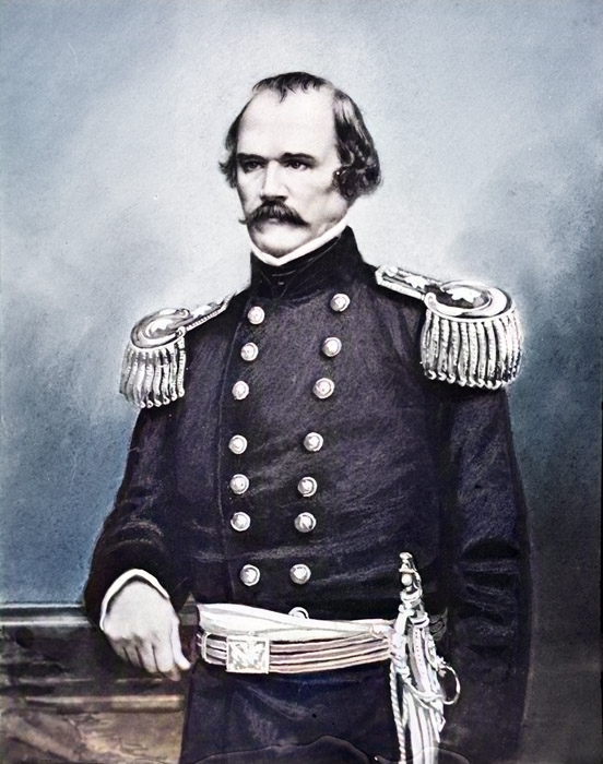
Colonel Albert Sidney Johnston.
That month, Johnston’s Army arrived in Utah, passing through the now-vacant Salt Lake City to establish Camp Floyd, about 50 miles distant.
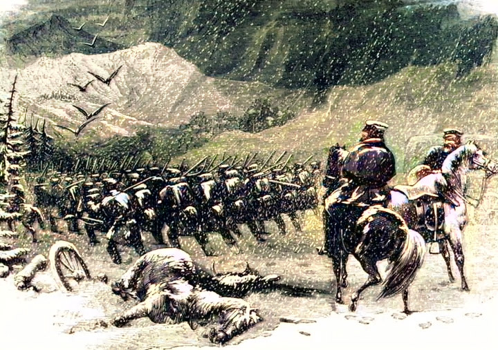
After the “Mormon War,” Bridger’s Pass saw little activity until 1862. By this time, the Civil War was in progress, and the military strength of the West was depleted. Indian harassment increased to such an extent that the Oregon-California Trail became unsafe to travel, and Ben Holladay’s Overland Stage and Express Company could not deliver the United States mail to the West Coast.
To avoid Indian depredations, a section of the Stage Line was relocated along a route over Bridger’s Pass. New stage stations along the Overland Trail were built regularly along the new route. One station was at Bridger’s Pass, 922 miles west of the Missouri River. Approximately ten miles east of Bridger’s Pass Station was Pine Grove Station, and ten miles west was Sulphur Springs Station. This section of the trail became one of the most brutal hits as the Indians continued to harass the stage line operation, culminating in the disastrous summer of 1865.
Between May 26 and June 22, attacks occurred at Bridger Pass, Sage Creek, Pine Grove, and Sulphur Springs. On June 2, Washakie Station was attacked, one man was wounded, and nine U.S. Cavalry horses were driven off. On the same day, two emigrants were killed in the Sage Creek area, and the country was raided for 50 miles along the mail line.
Afterward, 31 soldiers of the 11th Ohio Cavalry were sent from Fort Halleck to open the mail route. The Pine Grove and Bridger Pass stations were found deserted as all employees had retreated to the station at Sulphur Springs. At the height of these attacks, the mail was protected by stationing three to five soldiers and a non-commissioned officer at each stage station most likely to be attacked. A mounted cavalry escort also accompanied the stage at times of greatest peril.
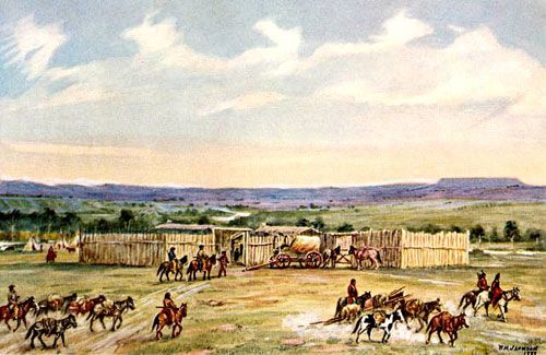
Fort Bridger, Wyoming.
On May 28, 1865, the First Battalion of the Nevada Volunteer Cavalry was sent east from Fort Bridger to patrol the Overland Trail. This contingent set up a temporary headquarters at Washakie Station and posted five soldiers each at Rock Spring, Salt Wells, Point of Rocks, Black Buttes, and Big Pond stations.
That year, in addition to disrupting stage travel and destroying stage stations and other property, the Indians ran off all the company’s livestock over a 100-mile stretch. They also killed several white men in their attacks.
Indian attacks declined in 1866, but the following year, fresh hostilities broke out as a result of the Powder River wars to the north.
From April 1 to August 15, 1867, the Overland Line reportedly lost 350 head of stage stock, 12 stations were burned, and three stage coaches were destroyed. During the attacks, 13 employees were killed. On June 4, 1867, two stagecoach men were killed on Bridger’s Pass, and the stock was driven off along the line for a distance of 45 miles east of Sulphur Springs Station. Bridger Pass Station was burned to the ground on June 6 without loss of life.
The Peace Commission of 1867 negotiated with the Indians for more than a year and eventually drafted treaties which, by late 1868, largely ended attacks along the Overland Trail in the new Wyoming Territory.
Overland Trail.
Use of the Overland Trail steadily declined after the completion of the first transcontinental railway in 1869. Superseded by the railroad, the Overland Stage Line suspended operations. Afterward, Bridger’s Pass was off the mainstream of the transcontinental movement.
Today, the Bridger’s Pass area serves local ranching interests and is relatively isolated from the modern world. A county dirt road traverses Bridger’s Pass, following the same general course as the old Overland Trail.
©Kathy Alexander/Legends of America, updated March 2025.
Also See:
James Bridger – Guide of the Rocky Mountains
Overland Trail Across the American West
South Pass – Gateway to the West
Sources:
National Register of Historic Places
Wikipedia
Wyoming History
Wyoming State Preservation Office