
Stagecoach Trail.
The Fort Wallace-Fort Lyon Trail in Kansas and Colorado was blazed as the Union Pacific Railroad pushed westward across Kansas.
A new end-of-track town called Sheridan was established in May 1868 in Logan County, Kansas, and the Southern Overland Mail and Express Company relocated its terminus there.

Butterfield Stage-wagon.
The following month, the stage line moved its headquarters to Pond Creek Station, a Butterfield Overland Dispatch stop established in 1865, 14 miles to the southwest. Near Fort Wallace, it was located near the western boundary of Kansas on Pond Creek, a tributary to the Smoky Hill River.
The Southern Overland initially projected a road running from Pond Creek Station by way of Cheyenne Wells to Bent’s Fort, and Dick Wootton laid out a road along the proposed route. However, this road was never developed, and a second route was plotted from Pond Creed Station through Cheyenne Wells to Fort Lyon, Colorado.
Having no official name, the road to Fort Lyon was known by several designations. Captain W. H. Penrose, Commanding Officer at Fort Lyon, referred to the road as the “stage route to Cheyenne Wells.” Luke Cahill, a stage company employee and former first sergeant in the Fifth Infantry at Fort Lyon, called the road “the trail between Lyon and Wallace.” Later, the road was commonly known as the Fort Wallace-Fort Lyon Road. This road eliminated another significant section of the Santa Fe Trail, the stretch running westward from Fort Dodge to Fort Lyon.
The stage line from Fort Wallace, Kansas, through Sharon Springs, Kansas, was laid out by a military captain who progressed westward from Willow Creek to Old Cheyenne Wells, originally known as Indian Wells, then almost due south to Fort Lyon, Colorado. It is said that no surveyors were used to locate this trail but that a Calvary captain familiar with the country between Fort Wallace and Fort Lyon would ride ahead of his cavalry regiment several miles and then signal the regiment to travel to his signal point. Then, halting them, he would go on several miles again to some high point visible to his regiment, and they would again move to the new location. The supply train and freighters followed up the regiment, and in one trip from Fort Wallace to Fort Lyon, a trail was easily identified by the perfect tracks of so many traveling on the trail. The trail began known as the Old Military Trail, which connected Fort Wallace on the Smoky Hill River with Fort Lyon on the Arkansas River.
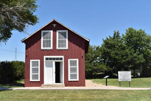
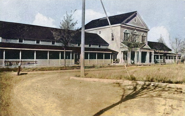
Pond Creek Stage Station at Fort Wallace, Kansas, by Kathy Alexander.
The northern end of the line was construed to be any of three locations: Sheridan, the railhead that received passengers, mail, and freight from the east; Fort Wallace, 12 miles southwest of Sheridan, which housed the post office established in 1866; or Pond Creek Station. The Southern Overland initiated a daily stage service to Santa Fe, New Mexico, on July 1, 1868.
Between Pond Creek and Fort Lyon, the stage company established six stations at varying intervals, each named for a water source: Cheyenne Wells, Sand Creek [Big Sandy], Rush Creek, Kiowa Springs, Well No. 1, and Well No. 2. Beyond Cheyenne Wells, originally a Butterfield Overland Despatch station 36 miles from Pond Creek Station, the threat of Indian attack was ever imminent. As early as August 30, 1868, Captain Penrose at Fort Lyon reported:
“The country between here and the Denver stage road, the Smoky Hill Trail, and also between here and Fort Dodge is overrun with hostile Indians; every precaution is taken to protect the Stages, the Trails, and the settlers in my vicinity as is possible to do without cavalry.”
While Penrose referred to the Indians in generic terms, it appears that most of the raiders were Cheyenne and, to a lesser extent, Arapaho and Kiowa.

Cheyenne Warriors by Edward S. Curtis, 1905.
At Sand Creek, 14 miles from Cheyenne Wells, Indians attacked the Big Sandy station on September 19. However, troops dispatched from Fort Lyon four days previously repulsed the raiders without any losses. One Indian was reported killed and another wounded in the exchange.
The Rush Creek Station, 15 miles beyond Sand Creek, never experienced Indian problems, but Kiowa Springs, 22 miles to the southwest, was not so fortunate. This station, kept by a Mr. Stickney, was attacked on August 25, 1868, but the Indians were driven off with no losses on either side.
On August 24, a coach returned to the station at Well No. 2, only 12 miles from Kiowa Springs, after proceeding about one mile toward Fort Lyon. A courier warned the conductor that Indians were in pursuit, so the conductor turned the coach around and raced back to the station. Waiting until darkness, the coach slipped away from the station and quietly made his way to Fort Lyon, arriving 12 ½ hours behind schedule.
Well No. 1 was 15 miles beyond Well No. 2 and seven miles from Fort Lyon. On August 28, 1868, 25 to 30 Indians surrounded the station. After observing the stage, company employees were prepared for the attack, and the Indians left without incident. At Well No. 1, Lydia Spencer Lane and her husband, William, stayed overnight in 1869 en route to the railhead at Sheridan. Mrs. Lane’s brief sketch of the property serves as a prototype of the stations on the Fort Wallace-Fort Lyon Road:
“We stayed all night at the small board shanty used as a mail station, occupying the state apartment, I suppose, for the walls were papered with illustrations from various pictorials. I had a suspicion the pictures were put there more to keep out the wind, of which there is an undue allowance of kind and quality in Colorado, than to embellish the room. It was a bright and cheery little place with windows that commanded a view of the country for miles in every direction.”
Following the Battle of Beecher’s Island in September 1868 northwest of Fort Wallace and the October 9 capture of Clara Blinn and her two-year-old son Willie east of Fort Lyon, the Cheyenne and their southern plains allies moved south of the Arkansas River to winter in the Washita River Valley. Then, the Fort Wallace-Fort Lyon Road traffic returned to a peaceful flow. Nevertheless, the Southern Overland officials armed their employees at company expense and, on December 5, requested Captain Penrose assign troops to each of the stations between Fort Lyon and Cheyenne Wells. At that time, only 24 men were available at Fort Lyon. Consequently, Penrose dispatched four men from Fort Lyon to escort stages southward and assigned three men to escort stages northward. Penrose informed his superiors:
“This arrangement does not seem to meet the approval of Mr. Barnum, [Superintendent of the Southern Overland Mail and Express Company], but is the best I can make.”

Cheyenne Dog Soldier
During the winter of 1868-1869, most southern plains tribes were subdued by General Phil Sheridan’s winter campaign and forced onto reservations in Indian Territory. The Cheyenne Dog Soldiers were an exception and were slow to surrender their freedom. In the spring of 1869, a contingency of Cheyenne comprised chiefly of Dog Soldiers moved north to the Republican River area in northwest Kansas, where they resumed their depredations on the Fort Wallace-Fort Lyon Road. At Sheridan, they ran off several hundred mules in May 1869, and the following month, they raided a caravan near Fort Lyon. Throughout the summer, numerous bands of Indians were reported along the Fort Wallace-Fort Lyon Road. Fortunately, no lives were lost in any of the encounters.
Trouble of a different sort occurred during the same period. While a stagecoach was en route to Well No. 2 from Fort Lyon, a driver named Huggins killed another stage company employee named Taylor. Because both men had been drinking, Huggins was not held responsible for Taylor’s death. He was relieved of his driving duties and assigned to Well No. 2 as a stock tender. Not finding the new duties to his liking, Huggins soon quit, and shortly afterward, the station was closed.
By this time, the town of Sheridan had grown to a population of 2,000, swelled by the lawless element common to end-of-track towns. A Reporter for the Topeka Commonwealth described the situation in the issue of August 4, 1869:
“The scum of creation have there congregated and assumed control of Municipal and social affairs. Gamblers, pickpockets, thieves, prostitutes, and representatives of every other class of the world’s people, who are ranked among the vicious, have taken possession of the town and reign supreme… Civil authorities are laughed at and disregarded, and crimes are rampant and predominant.”
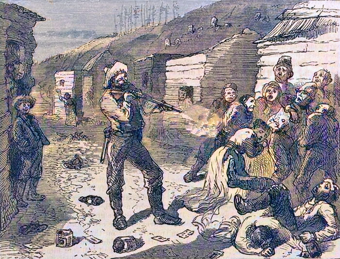
Shooting in Sheridan, Kansas Shooting by Harpers Weekly, 1875.
Regardless of such observations, a sizable proportion of the population comprised respectable personnel associated with giant commission firms, principally the Otero & Sellars Company and the C.H. Chick Company. Employing clerks by the score, these two firms operated mammoth wholesale operations disbursing goods to New Mexico by freight caravans operated by New Mexico merchants who found a ready market for their wool at the Sheridan railhead.
During the late 1860s, northwest Kansas was considered the West’s prime buffalo hunting area. Hunters by hundreds, with easy access to the railroad, made Sheridan their base of operations. Roaming the plains within a short radius of the railhead, they slaughtered buffalo by the thousands. Otero & Sellars pirated Moses Friedman from the C.R. Morehead Company of Leavenworth to conduct their wool, hide, and fur buying business to capitalize on the wool and buffalo trade. Miguel Otero recalled the company’s warehouses contained, at one time, 30,000 buffalo hides and 5,000 wolf skins, plus thousands of coyote, badger, skunk, and antelope skins.
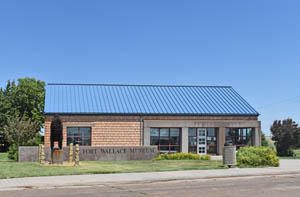
Fort Wallace, Kansas Museum by Kathy Alexander.
Fort Wallace’s population had increased to 286 soldiers, officers, and families and 168 civilians, totaling 479. Among the civilians were a few individuals associated with the newly built railroad station, Wallace, located north of the post. A row of officers’ quarters lined the north side of the parade grounds, and soldiers were quartered in four barracks. The temporary quarters and hospital tents occupied by the families of noncommissioned officers gave the post an “unfinished, if not unsightly, appearance.”
A post office was established at Pond Creek Station on November 30, 1868. The little settlement was named the temporary seat of government for Wallace County the same year. In 1869, the town gained municipal status when citizens filed for a city charter under the Pond City Land and Town Company. While the Southern Overland Company continued to dominate the town, Pond City attracted several other businesses, including a jewelry store owned by John Whiteford, Wallace County’s first justice of the peace.
In the meantime, as the Union Pacific Railroad changed to the Kansas Pacific Railroad on March 3, 1869, it extended westward in Colorado territory, and a new end-of-the-track town was being developed at Kit Carson. By December 1869, a population of 300 was living in tents, and eight frame buildings were under construction. In March 1870, the stage company abandoned Pond City and moved its offices to the Colorado terminus. In short order, Kit Carson took on the appearance of its Kansas counterparts with the usual array of dance halls, gambling houses, and saloons, in addition to the more respectable business houses associated with the commission firms and the railroad.
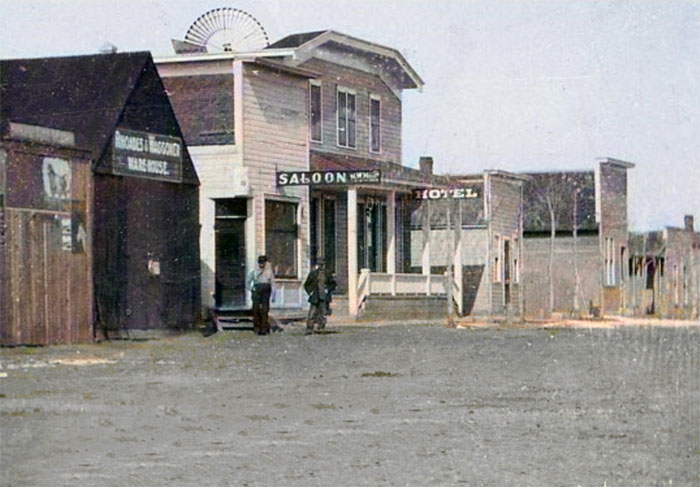
Kit Carson, Colorado.
With the stage and railroad headquarters relocated, a stage route was developed to Fort Lyon. Running due south from Kit Carson, the new road connected with the Fort Wallace-Fort Lyon Road at the Big Sandy Station and followed that older route to Fort Lyon, a total distance of 55 miles.
Expecting the southern terminus to be located at Las Animas, the town was founded in 1869 near Fort Lyon; the Southern Overland Company moved its receiving and shipping office from Kit Carson to the new town in early July. However, the railroad bypassed Las Animas to establish a new town four miles west called New or West Las Animas. The Southern Overland Company abandoned the original Las Animas location within no time. It moved its offices to the new place where it constructed a complex of stables and corrals within sight of an imposing water tower, engine house, and other railhead facilities. From West Las Animas, freight and stage traffic continued to move down over the mountain route of the Santa Fe Trail. In contrast, the Kit Carson/Fort Lyon Road and the McBride & Wootton freight route were no longer used.
Company A of the 5th U. S. Infantry was transferred from Fort Wallace to Kit Carson to protect the new road. As it turned out, however, the road was never threatened by an Indian attack, thanks to Major Eugene Carr’s overwhelming defeat of the Dog Soldiers at Summit Springs, Colorado, on July 18, 1869. Thus, the road seemed to be plagued more by a monotonous landscape than by Indians.
Fort Lyon, Colorado.
In April 1870, the area south of Kit Carson was described by a Denver correspondent as “a lifeless prairie, with naught to interest or attract the eye of the traveler.” The following year, Frances Roe, a young officer’s wife en route to Fort Lyon, offered a similar observation: “There was not one object to be seen on the vast rolling plains, not a tree nor a house, except for the wretched ranch and stockade where we got a fresh horse and a perfectly uneatable dinner.” The ranch’s location described by Roe remains unknown, but it would appear that it was the only station on the road at that date. Such is plausible as the stages, traveling four to six miles per hour, could cover the distance from Kit Carson to Fort Lyon in a single day.
During the summer of 1872, the Kansas Pacific Railroad reached Denver, Colorado. Consequently, government freight was no longer dispatched from Kit Carson by wagons. It was shipped through Kit Carson to Denver by rail, transported south to Pueblo on the Denver & Rio Grande Railroad, and then by wagon to the Mountain Route of the Santa Fe Trail at Trinidad. Stage traffic and most civilian freight continued to flow south from Kit Carson.
The closing of the roads from Kit Carson signaled the end of an era. The decade of 1863-1873 witnessed the gradual truncation of the Santa Fe Trail by the westward thrust of the Union Pacific-Kansas Pacific Railroad. The railroads replaced the Trail.
©Kathy Alexander/Legends of America, updated August 2025.
Also See:
Tales & Trails of the American Frontier
Sources:
Blakeslee, Donald J.; Holy Ground, Healing Water, Cultural Landscapes at Waconda Lake, Kansas; Texas A&M University Press, 2010.
Colorado State University
Kansas State Historical Society
Santa Fe Trail Research (discontinued website)