
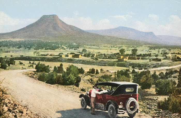
Old Oklahoma Highway.
The Ozark Trail Highway was a short-lived but significant cross-country highway organized by the Ozark Trails Association.
Before the establishment of the United States federal highway system, locally maintained roads and highways connected St. Louis, Missouri, to El Paso, Texas, and Santa Fe, New Mexico at the junction of the historic Santa Fe Trail. This network emerged as a result of rapidly advancing technology that fueled the growth of the automobile and tourism industries, as well as agricultural mechanization and the trucking industry, which started to thrive in the 1910s.

Ozark Trails Road Guide.
In 1913, William “Coin” Harvey, a lawyer, real estate developer, and entrepreneur in Arkansas tourism, established the Ozark Trail Association. Its mission was to promote the development of improved highways from St. Louis, Missouri, to Las Vegas, New Mexico, spanning across Missouri, Kansas, Arkansas, Oklahoma, Texas, and New Mexico. He and other “good roads” trailblazers saw the possibilities of community growth and prosperity through a system of marked roads linking towns, cities, and states.
This association was comprised of private citizens who aimed to encourage local municipalities to construct and maintain road systems throughout the Ozarks. In 1914, Cyrus Avery from Tulsa, Oklahoma, played a key role in organizing an Oklahoma branch of the Ozark Trail Association.
Harvey and his Ozark Trails Association did not plan to build the roads. They wanted to promote good roads and educate local communities on the various economic advantages of improved highways. It also provided information on highway design. They hoped local folks would build and maintain the roads, and the association would promote and publicize them.
Through a $5/year membership and donations, they financed an effort to encourage development and mark roads in seven states.
Over the years, the association held several national conventions. After much competition among cities wanting the route and among those promoting different paths, the main line routes were adopted in 1916 at the Oklahoma City, Oklahoma, convention. These included northern, central, and southern routes, comprising one of the first interstate roads west of the Mississippi River. Initially, these routes were often confusing with various diversions, and following section-line roads with right-angle turns every mile made for a slow, arduous journey.

Oklahoma City.
Final route selections were made at the 1917 Amarillo, Texas, convention, which was heavily influenced by the improvements made by those along the proposed routes. Generally, the more central route was chosen, including Tulsa and Oklahoma City, Oklahoma, Amarillo, Texas, and Las Vegas, New Mexico — establishing a corridor for future Route 66.
At first, the Ozark Trails Association marked the route by painting telephone poles green and white and then using diamond-shaped signs with a white background and a green “OT” between two green stripes. The association also distributed a guidebook with turn-by-turn directions, maps, photos, and town descriptions.
In about 1917, various sections of the road were hard surfaced with asphalt, concrete, and occasionally brick through projects generally funded by county and local bond issues. The Federal Road Act of 1916 also provided support.
At the 1918 convention in Miami, Oklahoma, Harvey proclaimed that the Ozark Trail Association had 2,000 miles of adopted and marked roads and was promoting an Ozark Trail of 7,000 miles. It was here that Harvey first proposed permanent markers on the trails, calling initially for 12 between Springfield, Missouri, and Las Vegas, New Mexico, at branch junctions, with a 50-foot-tall monument at Romeroville to signify the junction with the Santa Fe Trail.
Starvation Peak is between Las Vegas and Santa Fe, New Mexico.
After 1918, the association encouraged towns to build tall, slender, white obelisks with pyramidal tops and green directional lettering. The obelisks marked the various roads and indicated the distances to various towns and communities.
At the 1919 Roswell convention, controversy erupted over a proposal to extend the route south through Artesia and Carlsbad to Van Horn, Texas, to connect with the Old Spanish Trail. Known as the Pecos Valley Route, at the 1920 convention, this route won approval as an “alternative” route to El Paso, leaving the primary route from Roswell to El Paso via Alamogordo. In 1922, this route shifted from Malaga to Pecos, Texas, rather than to Van Horn.
These roads comprised the primary highway system in the region until U.S. Highway 66 was built in the 1920s. In Oklahoma, portions of the section-line roads between Anadarko and Hobart are still referred to as “The Old Ozark Trail”.
By this time, the Ozark Trails highway system had reached a peak. A numbering system on both national and state levels to identify highways had begun, and as it expanded, the need for named highways declined.
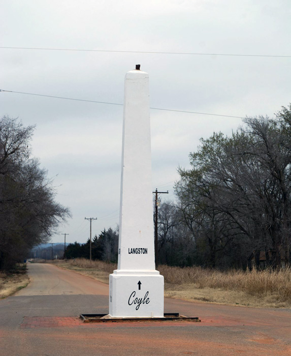
Langston, Oklahoma Obelisk, courtesy Oklahoma Historical Society.
In 1923, the U.S. government built the Newcastle Bridge over the South Canadian River between Newcastle, Oklahoma, and Oklahoma City, as the first federal highway project built in Oklahoma.
There were no Ozark Trails Association conventions held after 1924.
The Federal Aid Highway Act of 1925, which finally incorporated the Deep South into the Federal roads program, made the association’s basic functions obsolete, and it disbanded.
In 1926, the U.S. Office of Public Roads redesignated most of the Ozark Trail Highway as U.S. Highway 66. This highway extended from Chicago, Illinois, to Los Angeles, California, prior to the advent of the Interstate Highway System.
In the subsequent years, almost all of the tall white obelisks were destroyed or buried within a few years of the implementation of the uniform numbering system. Of the 21 that were constructed, only seven remain today in Stroud, and Langston, Oklahoma, and Dimmitt, Wellington, and Tulia, Texas. Another replica obelisk also stands in Farwell, Oklahoma.
Except for these monuments, the Ozark Trail Highway is but a memory today.
Stop worrying about the potholes in the road & enjoy the journey.

Ozark Trails Map, courtesy of Wikipedia.
©Kathy Alexander/Legends of America, May 2025.
Also See:
Byways & Historic Trails
National Old Trails Road
Midland Trail – First Transcontinental Auto-Trail
Route 66
Sources:
Historical Marker Database
Lubbock Avalanche-Journal
Oklahoma Historical Society
Wikipedia