
New Santa Fe, Missouri.
New Santa Fe, also known as Little Santa Fe, stood at the junction of the Santa Fe Trail and State Line Road in present-day southwest Kansas City, Missouri. The little village had great historical significance in developing Western commerce in the 19th century.
When the first wagon trains passed through on the Santa Fe Trail in the early 1820s, it was little more than an Indian settlement. Some records indicate that the first log cabin, a tavern, was built in what would become New Santa Fe in 1824. This location was initially called Blue Camp 20 because it was 20 miles from Independence and near the Blue River. A popular stopping place because of its grass, water, and room for camping, it became a wagon train outfitting station on the Santa Fe, Oregon, and California Trails.
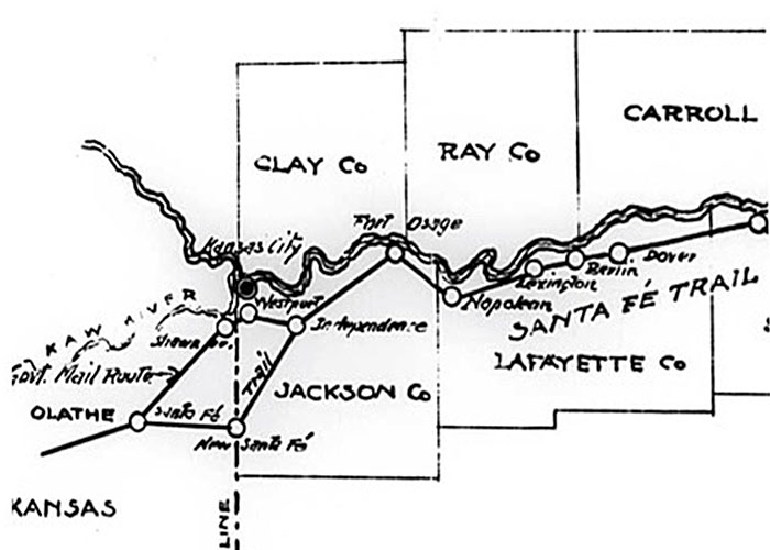
Santa Fe Trail Map.
Later, a village developed around John Bartleston’s farm, where he erected a forest cabin in 1833. It was situated on the west line of Missouri, about midway in Washington Township. Within a few years, the village of Little Santa Fe developed. Located a day’s trip from Independence, wagon caravans laden with merchandise for the Mexican and California trade would stop here before pushing westward.
In the mid-1840s, Dabney Lipscomb and his wife, Elizabeth, lived and cultivated their rich terrain on the rolling hills of Washington Township.
The Jackson County Historical Society reported that 40,000 Western emigrants departed Westport between 1847 and 1850.
Dabney Lipscomb and his wife, Elizabeth W. Lipscomb, laid out the town on October 5, 1851, and a post office was established that year. Dabney’s goal was to establish a town with materials, expertise, and the ability to assist travelers on their trip to the Wild West. At that time, its population was about 500. The village was incorporated as New Santa Fe the following year. Today, his land is where the Verona Hills subdivision is.
Travelers on the Santa Fe Trail could travel west from Independence to Westport or New Santa Fe. Thousands of pioneers opted for the route through this bustling little town instead of Westport, whose roads were reportedly “rocky.” But to travel through New Santa Fe, they had to cross the river.
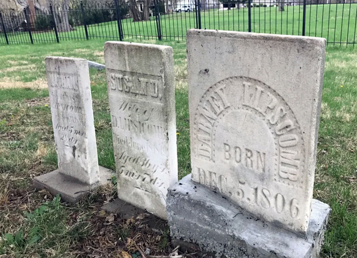
Lipscomb Graves.
Dabney Lipscomb passed away in 1854. He, his wife, and his son, Nathan, are buried at the New Santa Fe Cemetery.
Located on the line between a Free-State and a pro-slavery state, it suffered from the Border War of 1855-60 as Kansas Jayhawkers and bushwhackers decimated the town.
The original Red Bridge was constructed in late 1859. The 100-foot wooden structure, painted red, no longer required wagon trains to dredge through the Blue River. They crossed the bridge and then up the hill at Minor Park, where swales are evident today.
By 1860, New Santa Fe had grown to a population of 670. At its height, the town boasted a stagecoach stop, a blacksmith shop, a stonecutter, a mercantile business, an outfitting store, a hotel, a carriage maker, a school, a doctor, and a dentist.
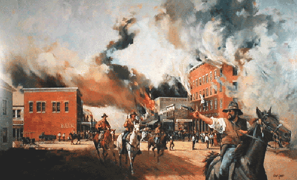
Border War between Missouri and Kansas.
During the Civil War, the village struggled for survival, contending with sporadic border skirmishes. The pursuing Federals camped here in New Santa Fe on the night of October 23, 1863, while Union commanders met at the Thomas Farmhouse (about four miles north of New Santa Fe) to plan their pursuit of the retreating Confederates.
In Independence, Missouri, on the morning of Saturday, October 22, 1864, Confederate General Sterling Price sent his wagon train toward New Santa Fe. Brigadier General William L. Cabell’s Brigade and several thousand unarmed recruits accompanied the wagon train and cattle herd. They aimed to reach the Military Road from Fort Leavenworth to Fort Scott, Kansas. After being defeated on Sunday, October 23, in the Battle of Westport, Confederate General Sterling Price’s Army retreated through New Santa Fe.
After the war, bands of outlaws who came created more depredations.
In 1869, families living in the county’s southwestern part organized the Santa Fe Christan Church in New Santa Fe. The congregation initially met at the schoolhouse. A white-framed church was dedicated in 1892.
By the time the New Santa Fe Cemetery was designated as a burial ground in 1880, trail traffic had dissipated. However, the ruts may still serve as a road for cemetery visitors. Though the cemetery post-dates significant trail traffic, it helped protect the ruts from the fate faced by most in the area. As Kansas City grew, the town of New Santa Fe was dismantled and replaced by modern development.
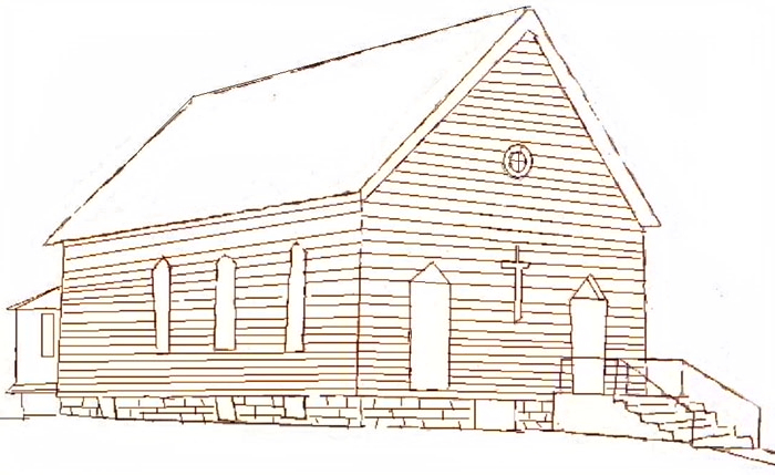
New Santa Fe, Missouri Christian Church.
The property making up the current cemetery was deeded by Dabney Lipscomb to the Santa Fe Christian Church in 1881 and remained church property for almost 100 years.
The village suffered when the railroad was built south of the town in what became Martin City, and finally, suburban development engulfed its final pieces and all that remained of the town.
By the 1960s, the Santa Fe Christan Church was one of the last buildings standing at the old site of New Santa Fe. A fire damaged part of it in November 1969, and it was razed in 1971.
In 1975, the church transferred ownership to the New Santa Fe Cemetery Association, which was initially composed of relatives of those buried in the cemetery. The Association and the New Santa Fe Historical Society were instrumental in preventing the construction of a shopping center on adjacent property in 1977. The area surrounding the cemetery was eventually developed as residential. The cemetery is not actively used. The Association is responsible for allocating the few remaining gravesites.
The only objects that exist today are the granite marker placed by the Daughters of the American Revolution in 1906 at the corner of Santa Fe Trail and State Line and the well-preserved New Santa Fe Cemetery at Santa Fe Trail and Belleview, which features faint wagon swales nearby. The site also features full-color wayside exhibits depicting the Santa Fe, Oregon, and California Historic Trails. It is one-half block east of State Line Road on W. Santa Fe Trail (between 121st and 123rd streets).
Wornall Road between Westport and New Santa Fe is the longest stretch of trail remaining in Jackson County, Missouri, today.

William Becknell blazes the Santa Fe Trail.
©Kathy Alexander/Legends of America, updated March 2025.
Also See:
Sources:
Civil War Muse
Martin City Telegraph
National Park Service
New Santa Fe
Waymarking